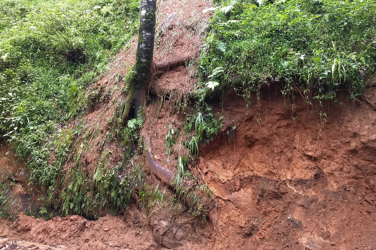
A landslide that buried a state transport bus near Burliyar on the Coonoor–Mettupalayam ghat road early on Saturday, October 24, killing its driver, came after Burliyar recorded 250 mm of rain in 24 hours. Landslides were reported at 19 places across the Nilgiris and traffic between Coonoor and Mettupalayam was suspended. Here is why this corridor is so prone to slides.
What is the corridor? The national highway and the Nilgiri Mountain Railway, the UNESCO-listed rack-and-pinion line, both climb from Mettupalayam in the plains to Coonoor. Burliyar and Katteri are the two main settlements along the road. Geological Survey of India and University of Twente researchers studied a 24-km stretch of the road and a 17-km stretch of the railway in a 2010 paper.
How often does it slide? That study catalogued 901 landslides from cut slopes along the road and railway between 1987 and 2007, mostly from railway slip registers and technical reports. A companion study in the journal Geomorphology put the average at about 20 landslides a year, with at least one landslide event every year except 1995.
Why here? The road and railway are cut through soil and laterite sitting on hard charnockite and gneiss rock. Where cutting exposes the boundary between bedrock and weathered soil, water builds up pressure along it during heavy rain and the slope gives way. About 94% of the landslides studied occurred on cut slopes rather than natural hillsides, and 97% were shallow debris slides.
Why now? The area gets rain in two spells: April to August, and October to December, when the retreating monsoon arrives and November is usually the wettest month. The heaviest single-day falls come in the October–December season, the Geomorphology study found. Of 94 landslide-triggering events it identified from 1987 to 2007, 71 were in October, November or December.
Is it just one heavy day? Not always. The researchers found that rain over the previous five days matters as well as the day’s total: wet ground needs less rain to fail. That is why a stretch of steady rain can set off slides on a day that is not, on its own, extreme.
How bad can it get? A single rainstorm in 2006 caused 88 landslides along the railway line, and in November 2006 the highway was closed for a few days, with traffic diverted via Kotagiri, a detour of about 32 km. In November 2009, heavy rain triggered landslides at more than 300 places in the Nilgiris and killed more than 40 people, according to a later engineering study.
Who is hit hardest? Small slides do outsized damage because the road is the shortest route up the hills. When it is blocked, Burliyar, in the middle of the stretch, is cut off completely, and businesses there can lose all their income, the 2010 study found. On Saturday, the district administration asked tourists to avoid Ooty until October 26.
More to read



Behind the story
Read the sources and explore the context for yourself.
- The Indian Idiot: Nilgiris landslide: bus driver killed as mud and trees bury TNSTC bus near Burliyar (24 Oct 2026)theindianidiot.com
- The New Indian Express: TNSTC bus trapped in landslide at Nilgiris’ Burliyar (24 Oct 2026)newindianexpress.com
- Jaiswal, van Westen and Jetten, Natural Hazards and Earth System Sciences: Quantitative assessment of direct and indirect landslide risk along transportation lines in southern India (2010)doi.org
- Jaiswal and van Westen, Geomorphology: Estimating temporal probability for landslide initiation along transportation routes based on rainfall thresholds (2009)doi.org
- Natural Hazards: Investigation on infrastructural damages by rainfall-induced landslides during November 2009 in Nilgiris, India (2013)ideas.repec.org
- ReliefWeb (The Times of India): Rain claims 29 more lives in Nilgiris (Nov 2009)reliefweb.int