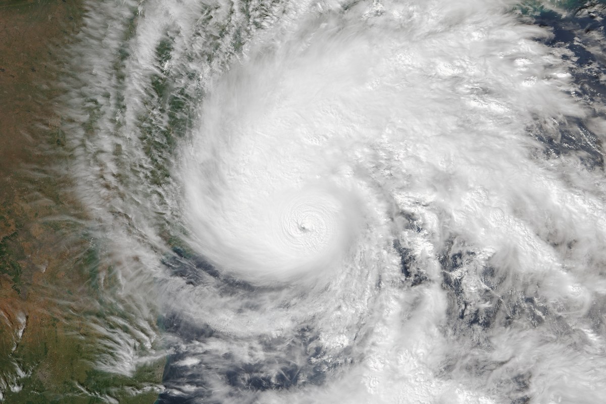
Very severe cyclonic storm Arnab is now expected to cross the Andhra Pradesh and Yanam coasts in the early hours of Wednesday (28 October), between 2 am and 4 am, the India Meteorological Department (IMD) said on Tuesday night. That is earlier than the forenoon landfall IMD had forecast through Tuesday.
“Due to faster movement, the landfall of cyclone is expected early. It is likely to make landfall during early hours (2-4 AM) of 28th October,” IMD said in a post on X at 9.25 pm. It said the storm’s outer spiral band had already entered the land.
View @Indiametdept’s post on X
At 5.30 pm on Tuesday, Arnab lay about 90 km southeast of Kakinada and 170 km south-southwest of Visakhapatnam, IMD said. It is expected to cross the coast between Bapatla and Visakhapatnam, close to the south of Yanam, with maximum sustained winds of 125–135 kmph gusting to 150 kmph.
Kakinada port has been placed under the No. 10 Great Danger Signal, which indicates that the cyclone may cross the coast in or near the area. Visakhapatnam, Gangavaram, Machilipatnam and Nizampatnam ports have been issued No. 8 Great Danger Signals, India Today reported.
IMD has warned of a storm surge of 1–2 metres above the astronomical tide, which could flood low-lying coastal areas at landfall. The highest surge is expected near the Kakinada and Yanam coasts.
The Andhra Pradesh State Disaster Management Authority said the storm was moving at 18 kmph. Extremely heavy rain was recorded at 28 locations and heavy rain at 133 locations since 8.30 am on Tuesday, and several districts could see heavy to extremely heavy rain until Wednesday morning, according to India Today.
Andhra Pradesh has shifted 84,396 people to 290 cyclone shelters, and the NDRF, SDRF, Navy and Coast Guard are on alert, India Today reported. More than 30,000 fishing boats have returned from sea. At least 21 flights were cancelled at Vijayawada and Visakhapatnam airports.
As The Indian Idiot reported on Monday, South Coast Railway cancelled 53 trains ahead of the storm, and schools and colleges in coastal districts including Visakhapatnam, Kakinada and Konaseema were closed from Tuesday.
More to read




Behind the story
Read the sources and explore the context for yourself.
- India Meteorological Department (@Indiametdept) on X (27 Oct 2026, 9.25 pm IST)x.com
- India Today: Cyclone Arnab live updates (27 Oct 2026)indiatoday.in
- The Indian Express: Cyclone Arnab to hit Andhra Pradesh coast on Wednesday, IMD issues alert (27 Oct 2026)indianexpress.com
- Hindustan Times: Cyclone Arnab tracker live: very severe cyclonic storm heads for Yanam (27 Oct 2026)hindustantimes.com
- The Indian Idiot: Cyclone Arnab turns severe; 89,000 being evacuated on Kakinada coast, 53 trains cancelled (26 Oct 2026)theindianidiot.com