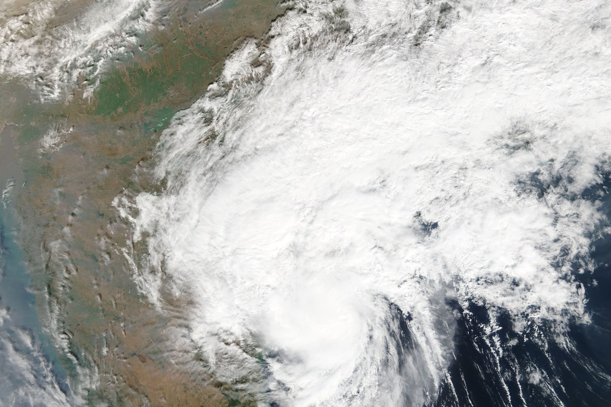
The Odisha government on Monday (16 November) ordered district administrations in the southern part of the state to begin early evacuation of vulnerable areas as a deep depression over the Bay of Bengal heads for Andhra Pradesh. The India Meteorological Department (IMD) says the system, which will be called Cyclone Akvan once it reaches cyclonic-storm strength, is likely to cross the Andhra coast as a very severe cyclonic storm.
What does IMD expect? In its 8.30 am bulletin on Monday, IMD said the deep depression lay near 11.2°N, 86.4°E, about 700 km east-southeast of Chennai and 800 km south-southeast of Visakhapatnam. It is expected to become a cyclonic storm on Monday evening and a severe cyclonic storm on the evening of 17 November. IMD then expects it to cross the Andhra Pradesh and Yanam coasts between Nellore and Tuni by noon on Friday (20 November) as a very severe cyclonic storm, with maximum sustained winds of 120-130 kmph gusting to 145 kmph, according to The Week, which carried IMD's post on X. Earlier forecasts had pointed to landfall around the night of 19 November.
What is Odisha doing? Ganjam Collector Keerthi Vasan V said the district has hilly areas and low-lying places that could be inundated. "Men and machinery are ready to begin shifting people well before the rains," he told reporters. Dainik Jagran reported that people living in vulnerable riverside areas of Ganjam will be moved to cyclone shelters from 17 November, and that areas flooded during the last cyclone and pregnant women have been marked for early shifting. Odisha has also put all 30 districts on alert, set up 24-hour control rooms and kept NDRF, ODRAF and fire service teams ready, Moneycontrol reported.
This will be Ganjam's third cyclone in three weeks, after Arnab and Murasu. The Indian Express reported that Arnab killed 11 people in Odisha and left six missing.
When will Odisha get the rain? IMD forecasts light to moderate rain on 18 November, with heavy rain at isolated places, and heavy to very heavy rain at isolated places from 19 to 21 November. Squally winds of 40-50 kmph, gusting to 60 kmph, are likely along the Odisha coast on 18 November, rising to 50-60 kmph, gusting to 70 kmph, from 19 November until the morning of 20 November. The Week reported an orange alert for Ganjam, Gajapati and Puri on 19 November. Fishing is advised against off Odisha from 18 November until the morning of 20 November.
Andhra Pradesh and Tamil Nadu are also on alert. Andhra's disaster management authority has warned of heavy rain and squally winds along the coast and told fishermen not to go to sea, while Tamil Nadu has asked fishermen to stay ashore from 16 to 21 November. Chennai and neighbouring districts can expect heavy rain from 17 November, The Indian Express reported. For what the name Akvan means and how IMD names storms, see The Indian Idiot's explainer.
More to read



Behind the story
Read the sources and explore the context for yourself.
- The Hindu (PTI): Odisha orders early evacuation of vulnerable areas as cyclone threat looms (16 Nov 2026)thehindu.com
- The Week: Severe cyclonic storm Akvan: District-wise breakdown of rainfall warnings for Odisha (16 Nov 2026)theweek.in
- Hindustan Times: LIVE: Cyclone 'Akvan' may form today, turn 'very severe' in 3 days, says IMD (16 Nov 2026)hindustantimes.com
- The Indian Express: India News Live Updates, 16 November 2026 (cyclone threat)indianexpress.com
- Moneycontrol: Cyclone Akvan: Odisha alerts all 30 districts as storm brews over Bay of Bengalmoneycontrol.com
- Dainik Jagran: ओडिशा पर मंडराया 'अकवान' का खतरा, नदी किनारे बसे गांव होंगे खालीjagran.com
- The Indian Idiot: Cyclone Akvan explained: name, path and who gets rain (15 Nov 2026)theindianidiot.com